GravitasEDGE
GravitasEDGE revolutionizes operational geology software by leveraging cloud technology to enhance collaboration and efficiency in well management. It features industry-leading applications like Winlog and PoreView for advanced log analysis and reporting. The innovative mobile app enables real-time access to crucial data, empowering users to streamline workflows across multiple disciplines throughout the well lifecycle.
Top GravitasEDGE Alternatives

StackScan
Identify and analyze websites by their tech stack with access to 50,000+ technologies and a database of 105 million domains.
Canesis Data
Canesis Data offers explorationists affordable access to an extensive collection of seismic and well data from around the world.
LEAMAP
LEAMAP facilitates the conversion of hard-copy seismic maps into digital formats, enabling efficient data import and editing across over 60 raster file types.
Seequent Central
Seequent Central enables geoscience teams to visualize, integrate, and manage geological data in a centralized cloud environment.

LEASSV
LEASSV Seismic Vectorizing Software expertly re-vectorizes scanned seismic images, transforming them into industry-standard SEG-Y format trace files.
RokDoc
RokDoc leverages over 20 years of research and industry experience to enhance hydrocarbon exploration and production.
GPT GES
GPT GES is a specialized geology and seismic software designed for advanced reservoir modeling.
Katalyst
Utilizing proprietary software and over 25 years of expertise, Katalyst efficiently converts historical data to...
g-Platform : Acquisition QC
This innovative solution streamlines the workflow, ensuring optimal results in structural, geological, dynamic, and reservoir...

Kinemetrics PSD
It enables users to evaluate the quality of acquired data in the field, read various...
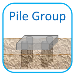
Geotechnical Engineering Modelling Software (GEMS)
Users can analyze various foundation types, including beam and pile foundations, through a cloud-based platform...

MFrac Suite
By optimizing planning and integrating real-time data, it enhances treatment confidence, identifies productive zones, and...
Geophysics by SeisWare
With integrated 2D and 3D mapping tools, users can seamlessly analyze and share seismic data...
MinePortal
By providing real-time insights and unifying operations, it facilitates optimized blast performance and precise orebody...
Geology by SeisWare
It facilitates real-time collaboration among teams, enabling seamless integration of geoscience data...
MiVu
It enables interactive geologic model building, optimal monitoring geometry design, and customizable data processing workflows...
Top GravitasEDGE Features
- Cloud-based geological workflow
- Real-time collaboration tools
- Mobile app for accessibility
- Integrated drilling and geoscience
- Multi-well correlation capabilities
- Pore pressure monitoring features
- Automated reporting to Word
- API for operational geoscience
- DataBridge for global connectivity
- Seamless data geolocation
- Single data source reference
- Flexible annual pricing model
- No upfront license fees
- Enhanced machine learning capabilities
- Intermittent communication support
- Comprehensive well lifecycle management
- Rich visualization toolset
- Workflow orchestration for clients
- Eliminates data silos
- Online training and consultancy services